


Lot n° 73
Estimation :
150 - 200
EUR
Result with fees
Result
: 361EUR
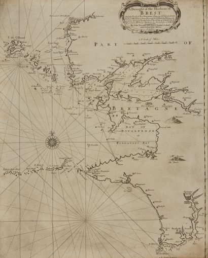
THORNTON, J. A Draught of the Harbour of Brest. London, ca. - Lot 73
THORNTON, J. A Draught of the Harbour of Brest. London, ca. 1690. black and white. Incomplete map. Fine printing + Cordier. Lot of maps. 550 x 440 mm.
Shows the west coast from Portsal to Penmarks.
A scale of 15 miles of England (11.25 cm). A wind rose. Depths, but only in the
depth, but only in the roadstead of Brest. This map shows us: seven windmills, four watermills, two guardhouses, a passage, a canonship, a
passage, a canonry, a hermitage, a Capuchin abbey.
To note, the Pettit folgitt (Folgoat), south of the abbey of Lavenne
§ Copy reproduced in "Anciennes Cartes Marines de la Bretagne 1580-1800". Anciennes Cartes Marines de la Bretagne 1580-1800, Pl. N°21.
Joint: JAILLOT/CORDIER. Part of a map from Douernenez to Benaudet. 452 x 665 mm. Moisture stains. Compass rose with fleur-de-lys, scale cartouche decorated with boats.
My orders
Sale information
Sales conditions
Return to catalogue